
The Near Miss and Dangerous Locations Reporting and Dashboard application is used by NoVA FSS and its chapters in Fairfax, Alexandria, and Arlington to inform transportation and officials where there are high-risk locations that require attention — before people are killed.
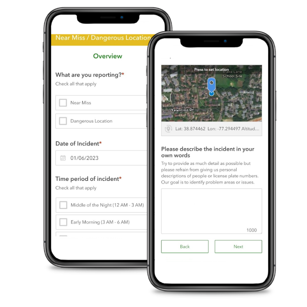
To report a near miss, dangerous location or an existing crosswalk, signal or sidewalk that needs to be addressed – use the Northern Virginia Families for Safe Streets(NoVA FSS) Near Miss / Dangerous Location Survey to file a report. Reports can be submitted in English, Spanish, Vietnamese and all languages spoken by Northern Virginia residents based on your browser’s language settings.
To view reported data, use the newly upgraded Near Miss/Dangerous Locations Dashboard. The dashboard is easy to use and enables you to see areas of concern and risk that have been recorded by your neighbors.
For an overview on how to navigate and use the dashboard – please use our Quick Start Guide.
More detailed instructions are available in our User Guide

About
The Near Miss and Dangerous Locations Reporting and Dashboard application was developed by North Virginia Families for Safe Streets (NoVA FSS) and launched in June 2021. The dashboard is a visualization of crowdsourced Near Miss and Dangerous Location reports provided by people who walk, bike or drive on Northern Virginia streets, roads and sidewalks. TREDS (Traffic Records Electronic Data System) data is also provided in the dashboard to allow exploration of potential correlations between Near Miss, Dangerous Location and actual crash data provided by the Virginia Department of Motor Vehicles.
The collected data is available to the public at no cost. This data is also used to inform Virginia Department of Transportation (VDOT), Fairfax County Department of Transportation (FCDOT), Alexandria Transportation and Environmental Services (T&ES), Arlington Department of Environmental Services (DES), and our elected where there are high risk locations that require attention — before people are killed or injured.
Credits
The initial version of the Near Miss and Dangerous Locations Reporting and Dashboard was developed with support from Virginia Tech Master’s in Urban and Regional Planning program. A new version was released in January 2023. This update was funded by a grant from the Metropolitan Washington Council of Governments (MWCOG) and fulfilled by Kleinfelder.